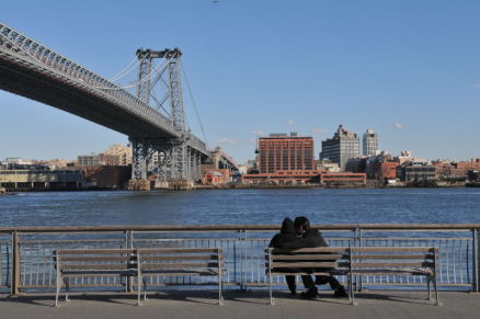
Manhattan may be surrounded by water, but it doesn’t always feel that way. Take some time this summer to explore the city’s waterfront and learn more about the green and blue spaces of New York.
Here are a few ideas to get you started:
- Visit the South Street Seaport Museum – a project of the Museum of the City of New York. Upcoming exhibits and events include: Mannahatta/Manhattan: A Natural History of New York City, Brooklyn Bridge Walking Tours, and Architectural Walking Tours of downtown Manhattan.
- Switch up your commute or just enjoy the sea breeze and the views on the East River Ferry. Bikes welcome aboard. Stops include midtown Manhattan, Brooklyn, and Governor’s Island.
- Kick back with some friends and enjoy the view of the water at Frying Pan, a salvaged boat turned bar and restaurant. Docked at Pier 66, at 26th St and West Side Highway.
- Boat the New York City Water Trail, which connects 160 square miles of waterways throughout the five boroughs and allow kayaks, canoes, and row boats.
- Show up early for a free boat rental at the Brooklyn Bridge Park Boathouse every Saturday 10:30 am – 4:30 pm through September 1.
- Known for its boardwalk and amusement park, Coney Island also boasts miles of sandy beaches and activities like volleyball, basketball, and saltwater fishing.
- Visit PortSide – a salvaged oil tanker that hosts public events while floating in the water, as well as a land-based museum in Red Hook.
- Check out five art installations along the southern shoreline of Randall’s Island Park. On display through October 31, 2012, sponsored by Randall’s Island Sports Foundation (RISF), The Bronx Museum of the Arts, and Made Event.
- Participate in a city planning process like River to the People – the East River Blueway Plan. It’s easier than it sounds! Go to their website to complete a brief survey and learn more about development plans for the blueway.
- Learn more about the planning future of the city’s waterfront by reading the NYC Department of City Planning’s Vision 2020: New York City Comprehensive Waterfront Plan.
Photo: Daniel Avila