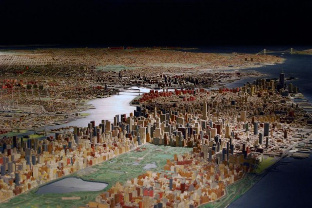
How can the public best visualize New York City — and surrounding coastline — changing in the years after Hurricane Sandy?
Peter Fleischer proposes a scale model of the city and waterfront, complete with wave action, that would allow the public to engage with the process of designing and implementing coastal defenses as we plan for a warmer future. Fleischer is the executive director of Empire State Future, a nonprofit that advocates and advises on smart growth in New York State; from 2003 to 2007, Fleischer was Senior Vice President of Empire State Development Corporation’s Governors Island subsidiary.
___
The New York region needs what both Sausalito, California and Vicksburg, Mississippi have. A publicly accessible venue and comprehensible means to determine what jetties, sea walls, green solutions; other structures, actions or non-actions would best reduce shorefront damage to our communities and manmade and natural assets from future Hurricane Sandy-size storms that climate change makes a virtual certainty.
This gathering place and tool ought facilitate time and fiscally constrained dialogue among the experts, politicians, environmentalists, community groups, advocates, maritime interests and other residents and users of the harbor who will evaluate the feasibility of proposed alternatives, their likely cost-effectiveness and the considerable, perhaps painful trade-offs they will engender. Most importantly, this venue will provide a focus for efforts to ensure that the urgency needed to address our coastal and shorefront challenge is not lost.
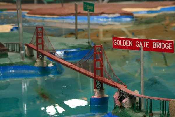
In 1957 in Sausalito, the United States Army Corps of Engineers opened the “San Francisco Bay Area Model” to analyze the feasibility, costs and impacts of major dam, flood control, and other proposed engineered projects affecting San Francisco’s iconic bay. Today, called the “Bay Model Visitor Center” that 2-acre scale model is visited annually by 150,000 students, tourists and experts from around the world.
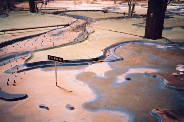
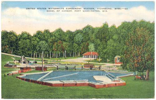
In Vicksburg, Army Corps scientists and engineers operate dozens of such acre-sized scale replicas of U.S harbors, rivers and coasts in which they model waves, currents and tides, while sophisticated computer models analyze the effect of storms, surging waters, wind and other natural forces.
The models test how a jetty, sea wall, dam, sand dune, oyster bed, or other natural or engineered solution might interact with a given harbor’s physical characteristics, its docks, depths, islands, ship channels, beaches, bulkheads, rivers and marshes under diverse, including severe, weather conditions. Modeling allows the Corps to perform scale experiments to evaluate many interconnected, possibly expensive alternatives, before approvals are given or construction begins.
Congress has approved $60+ billion to help the tri-state region recover, rebuild and prepare for the future. Fundamental decisions will need to be made. The Mayor has proposed 400 thoughtful and detailed pages of ideas and approaches. The next Mayor will need to pick up this heavy, complicated and fraught ball. Governor Cuomo has organized Coastal Resiliency Zones to advise the state on needed local actions. Our collective future will require choices and knowledge unlike what government or the public has been exposed to or prepared for in the past.
Ideas to protect us are numerous–sea walls, dunes, hardened assets, oyster beds, new wetlands, rebuilding, relocation, resilience–but they are not well understood by the general public, not sufficiently tested in local waters or coordinated with our neighboring states. London, Rotterdam, and Tokyo built modern engineered storm defenses. So have Stamford, Connecticut and Providence, Rhode Island, and they work. Mayor Bloomberg has now proposed various sea walls, revetments, bulkheads, dunes, etc. But what will work here?
[pullquote align=”left”]Our collective future will require choices and knowledge unlike what we’ve been exposed to in the past.[/pullquote]
The Army Corps, the federal agency responsible for coastal structures and inland navigation can help find answers. It is their job. They are authorized, staffed with scientists and marine engineers and able to be funded by Congress. The Corps and any other experts will need to model any major New York area work. They should bring their modeling here!
The regional waterfront (from Cape May in southern New Jersey to the eastern entrances of the Long Island Sound near Rhode Island and Connecticut) is among the world’s most complex and valuable. There are three major entrances to the port, over a thousand miles of built-up or protected shoreline, essential wetlands and habitats, four major rivers, millions of nearby residents, office buildings, essential municipal infrastructure including airports, highways, and sewage treatment plants as well as power plants, gasoline storage and port facilities. Damage, disruption, or delay can lead to tragedy, dislocation and billions of dollars from economic loss as we have seen.
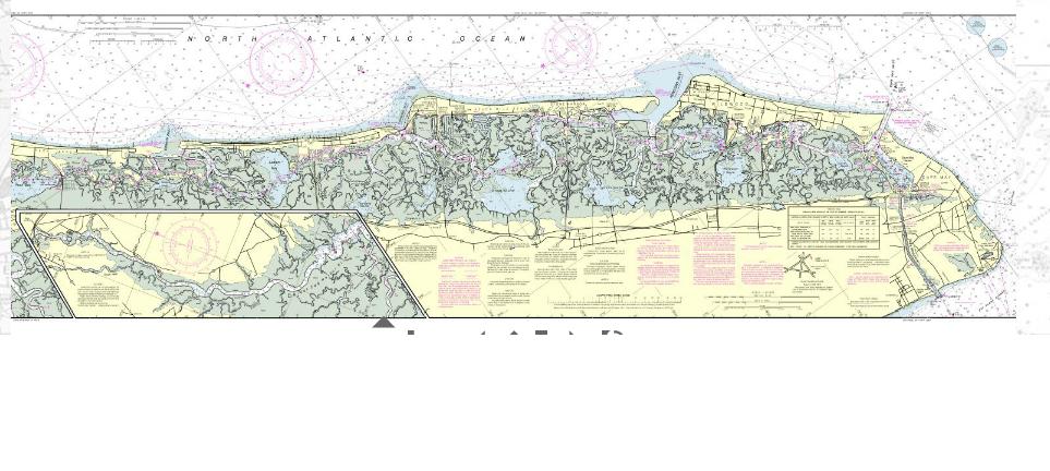
The Corps is certainly not perfect. Critics say that their dams, levees and beach replenishment strategies have underperformed, sometimes failed.
Others say the Corps overly relies on big, engineered solutions. Still others note the Corps is largely insensitive to local and community input. That’s why their work needs to be public, here and now.
The general public, local community groups, NGOs and politicians need to better understand the likely effectiveness, financial and human costs, and trade-offs (diversion of storm surge from a given state, community or asset may increase the repercussions on other states, communities or property) inherent in the choices we face, including the choice not to act. We need to agree, or agree to disagree, up front.
Sited within our harbor, supplemented by computers, linked to the Internet, and surrounded by amphitheater seating, with sound and lights, a model and visitor center, designed and built with resilience, would facilitate the needed decision-making.
[pullquote align=”right”]A new scale model of the city could be sited on Governors Island or Liberty State Park.[/pullquote]
The model could be sited on Governors Island or at Liberty State Park. They are at the center of the region and harbor, and are accessible by transit and ferry. They have space, and might benefit from four-season use and visitation. Gateway, Bridgeport, Beacon, even Peebles Island on the Hudson River near Albany might work too.
The Corps can build a physical model with pumps, pipes and flowing water in 6-12 months for a few million dollars — a wise investment if it usefully informs governmental preventive and ameliorative infrastructure choices here, and along the now-threatened east, west and gulf coasts of the U.S. A less costly alternative that would still allow for ongoing expert input, public education and engagement, stakeholder inclusiveness and a time and fiscally constrained decision making process could be opened in 120-180 days at an existing public venue for a fraction of the above amount.
To get our region started, the Corps and other experts, engineers and scientists should be deployed to the NY area. Immediate funding for this initial venue should come from FEMA’s Hazard Mitigation Program supporting community projects that reduce risks, the Corps’ mandatory public education budget or a portion of the CDBG funds now in process. We cannot afford to find ourselves arguing when the next storm hits.