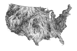
We have all seen those pictures of planet Earth as little blue and white marble against the backdrop of space and a hundred different maps of the world, but there are a few more images of our home that are worth a look. EarthSky recently posted a one-minute video of the history of human global CO2 emissions, which is at the same time interesting and alarming. NASA has released “the most high definition image of Earth” ever from a satellite. And finally, a beautifully rendered real-time updated map of wind patterns across the United States, with some information about it here.